Project Technical Sheet
Project 6
Perch River
A near-surface copper deposit with a 548 m exploration ramp (1973) on Route 167, surface samples up to 9.02% Cu and historical (non-NI 43-101) estimates.
- Commodities
- Copper, Silver
- Region
- Chapais–Chibougamau, Québec
- Status
- To be provided
- Claims
- 72 · 3,907 ha (100% MRB)
- Underground work
- 1973 ramp, 548 m extension, max. depth 70 m
- Metallurgy
- 98% copper recovery (COREM test, 2008)
- Access
- ≈ 68 km north-east of Chibougamau · Route 167, year-round
Project summary
Perch River is a copper project of 72 claims covering 3,907 ha, held 100% by MRB, about 68 km north-east of Chibougamau along Route 167. The property stretches about 14 km to the north-east, along a corridor of EM conductors.
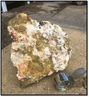
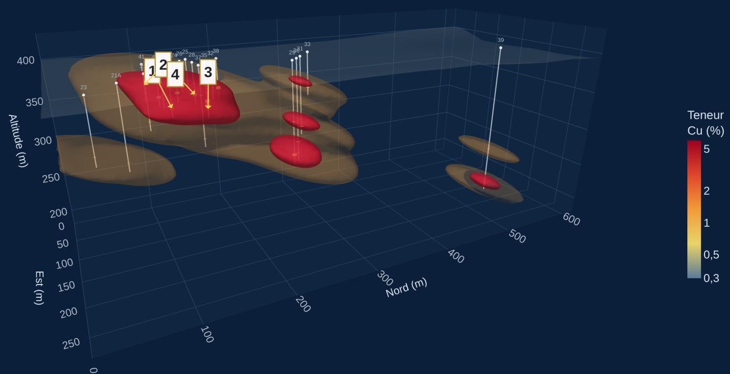
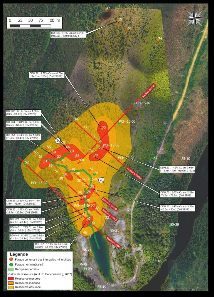
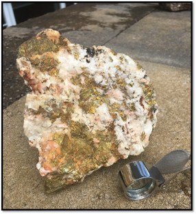
The tabular copper deposit lies near surface, in the same graphitic shale horizon as the former Icon Sullivan mine (1967–1976). An exploration ramp was driven in 1973, with a 548 m underground extension reaching a maximum depth of 70 m; that year, 12,150 t were sent to the Icon pre-concentrator, with a recovery judged satisfactory, and a metallurgical test by COREM in 2008 returned 98% copper recovery. About 123 historical drill holes and surface samples show copper mineralization, with surface grades up to 9.02% Cu.
MRB sees a 4 km favourable corridor along the sediments–Grenville contact and considers the mineralization a candidate for ore-sorting tests. The project is accessible year-round by Route 167.
Location
The claim blocks lie between latitudes 50.30° and 50.41° N and longitudes 73.64° and 73.76° W.
Historical exploration results
Results from earlier exploration work, as reported in the sources cited (GM numbers refer to assessment reports in Québec's SIGÉOM database).
| Result | Sample / location | Block | Reference | Date |
|---|---|---|---|---|
| 9.02% Cu | Surface sample | – | GM 67480 | – |
| 5.85% Cu and 4.50% Cu | Surface samples | – | GM 56380 | – |
| 5.6% Cu and 2.4% Cu | Surface samples | – | – | 2007 |
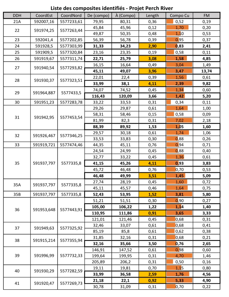
| 3.47% Cu over 3.96 m | Drill-hole composite, hole 27, from 45.11 m | – | – | – |
| 3.81% Cu over 1.52 m | Drill-hole composite, hole 35B, from 52.43 m | – | – | – |
| 2.39% Cu over 4.11 m | Drill-hole composite, hole 28, from 33.99 m | – | – | – |
| 5.33% Cu over 0.92 m | Drill-hole composite, hole 41, at 21.2 m | – | MRB project sheets 2026 (Punch Xplor V10) | – |
Historical estimates (non-NI 43-101)
These historical estimates do not comply with NI 43-101. A qualified person has not done sufficient work to classify them as current mineral resources or reserves, and MRB is not treating them as such.
| Result | Sample / location | Block | Reference | Date |
|---|---|---|---|---|
| 300,000 short tons at 1% Cu | Historical estimate (“inferred” category), not compliant with NI 43-101 | – | – | – |
| 32,000 t at 2.00% Cu (“measured”) and 150,000 t at 1.50% Cu (“indicated”) | Historical estimate, 1997, not compliant with NI 43-101; categories as reported at the time | – | MRB project sheets 2026 (Punch Xplor V10) | 1997 |
Some exploration results presented here are historical in nature and have not been verified according to current NI 43-101 standards. Grab samples are selective by nature and are not necessarily representative of the mineralization on the property.
Targets for the next phase
Exploration targets are conceptual in nature and subject to further exploration work. They are not mineral resources.
- Target 01 – Ore-sorting tests
Test how the copper mineralization responds to ore sorting, and drill the extensions of the deposit. - Target 02 – 3D model of the historical drilling
Build a database and a 3D model of the approximately 123 historical drill holes. - Target 03 – 4 km corridor
Drone magnetic–EM and IP surveys over the 4 km corridor along the sediments–Grenville contact, including the northern part of the property not covered by the 2024 magnetic survey.
Regional geological context
Information on neighbouring properties, reported by other companies. These are not MRB results, and mineralization on neighbouring properties is not necessarily indicative of mineralization on Perch River.
- Former Icon Sullivan mine. The former Icon Sullivan mine, about 13.7 km to the south-west in the same graphitic shale horizon, produced 1.6 Mt at 3.07% Cu from 1967 to 1976. (Source: MRB project sheets 2026 (Punch Xplor V10))
- Troilus mill and Copper Rand plant. Perch River lies about 92 km as the crow flies from the Troilus mill (Troilus Gold) and 65 km from the Copper Rand plant in Chibougamau. (Source: MRB project sheets, Chibougamau congress (v3), November 2026)
Maps and photographs
Technical references
Sources cited on this sheet. GM numbers refer to assessment reports in Québec's SIGÉOM database.
- GM 67480
- GM 56380
- MRB project sheets 2026 (Punch Xplor V10)
- MRB project sheets, Chibougamau congress (v3), November 2026
- MRB project sheets, Chibougamau congress (final), November 2026
- MRB corporate presentation, 2026
- MRB ArcGIS map, layer “Contours MRB”