Project Technical Sheet
Project 3
Dragon Gold
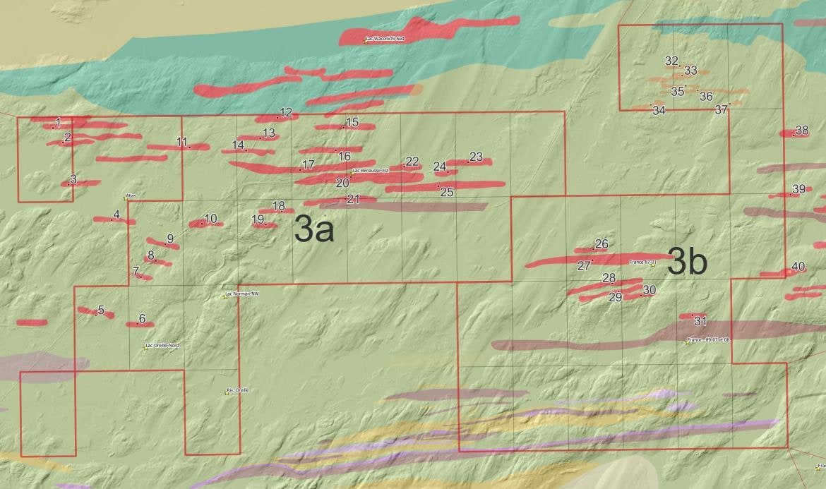
A swarm of 40 gold-bearing quartz-feldspar porphyry dykes along Route 167, 25 km north-east of Chibougamau, with gold in every channel of the Route 167 showing.
- Commodities
- Gold, Copper
- Region
- Chapais–Chibougamau, Québec
- Status
- To be provided
- Project no.
- 3 (sub-projects 3a to 3f)
- Claims
- 100 in 11 blocks · 5,539 ha (MRB and F. Guillemette 100%)
- QFP dykes
- 40 on the project · main dyke ≈ 1.4 km × 100–150 m
- Sub-projects
- 6
Project summary
The Dragon Gold project comprises 100 claims in 11 blocks covering 5,539 ha, held 100% by MRB and F. Guillemette, along Route 167 about 25 km north-east of Chibougamau, in the Chapais–Chibougamau area of Québec. It covers six sectors: 3a Dragon Gold 167, 3b Zone 32, 3c Dragon NE / Waconichi, 3d Cummings, 3e Dragon West and 3f Route du Nord.
Gold is associated with quartz-feldspar porphyry (QFP) dykes, the largest concentration of these dykes in the region. The main dyke at 3a is about 1.4 km long and 100 to 150 m wide, yet it has been tested by only four drill holes and never drilled at depth. Of the 84 QFP dykes identified on nine map sheets, 40 lie on the Dragon Gold project.
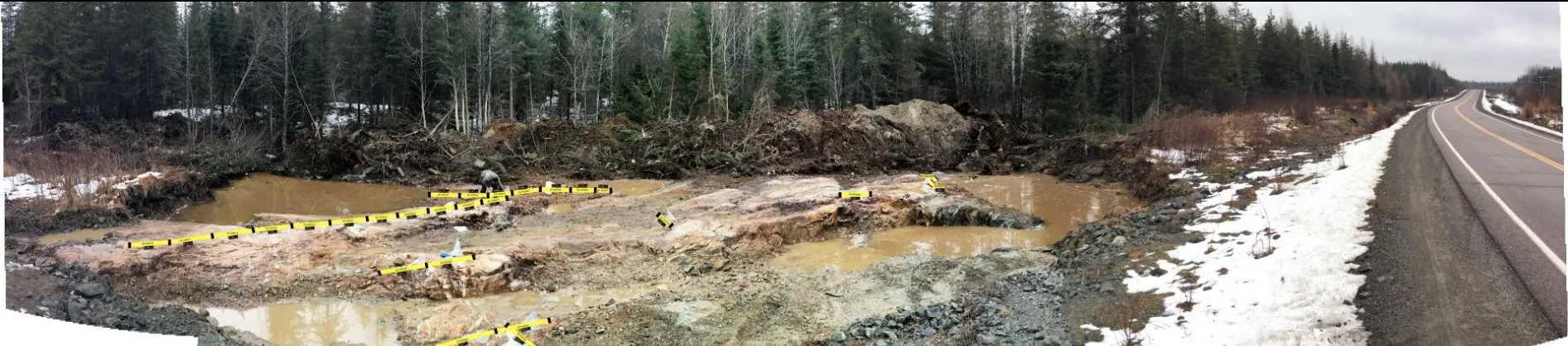
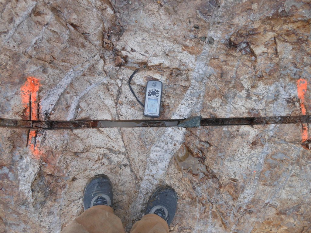
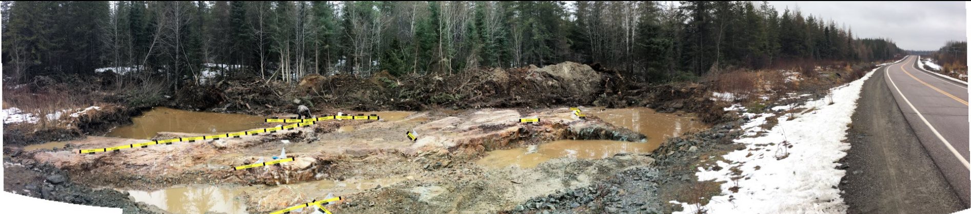
Stripping of the central outcrop along Route 167 in 2016 returned 0.64 g/t Au over 28 m in channel samples, including 6.33 g/t Au over 1 m: every channel of the showing carries gold. A new forestry road now reaches the 32 g/t Au boulder of Zone 32. MRB interprets the project as a possible eastern extension of the Norbeau gold veins and sees the QFP dykes as candidates for ore sorting.
Location
The claim blocks lie between latitudes 49.94° and 50.03° N and longitudes 74.01° and 74.27° W.
6 sub-projects
| Block | Sub-project | Exploration focus |
|---|---|---|
| 3a | Dragon Gold 167 | Main QFP dyke along Route 167: 2016 central stripping and four historical drill holes. |
| 3b | Dragon – Zone 32 | QFP dykes around a 32.02 g/t Au boulder found by SOQUEM in 1988; new forestry access. |
| 3c | Dragon NE / Waconichi | Description to come. |
| 3d | Cummings | Gold–copper: historical drill hole QT-8 (1956). |
| 3e | Dragon West | Description to come. |
| 3f | Route du Nord | Description to come. |
Historical exploration results
Results from earlier exploration work, as reported in the sources cited (GM numbers refer to assessment reports in Québec's SIGÉOM database).
| Result | Sample / location | Block | Reference | Date |
|---|---|---|---|---|
| 0.64 g/t Au over 28 m | Channel samples at surface, central stripping, Route 167 showing (incl. 6.33 g/t Au over 1 m) | 3a | MRB project sheets 2026 (Punch Xplor V10) | 2016 |
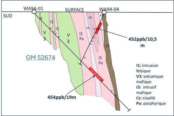
| 0.454 g/t Au over 19 m | Drill hole WA-94-01, from 85 m | 3a | GM 52674 | – |
| 0.452 g/t Au over 10.5 m | Drill hole WA-94-04, from 7.5 m | 3a | GM 52674 | – |
| 5.48 g/t Au and 16.1 g/t Ag over 0.8 m | Drill hole WA-94-02, at 89.2 m (only 5 m of the hole sampled) | 3a | GM 52674 | – |
| 18.7 g/t Au and 45.6 g/t Ag | Route 167 showing (km 265.65) | 3a | – | 1991 |
| 32.02 g/t Au | Boulder at surface found by SOQUEM, Zone 32 | 3b | GM 48298 | 1988 |
| 3.9 g/t Au over 0.5 m | Drill hole 88-02, at 87.9 m | 3b | MRB project sheets 2026 (Punch Xplor V10) | 1988 |
| 10.3 g/t Au and 1.35% Cu over 0.4 m | Drill hole QT-8 (depth not reported) | 3d | MRB project sheets 2026 (Punch Xplor V10) | 1956 |
Some exploration results presented here are historical in nature and have not been verified according to current NI 43-101 standards. Grab samples are selective by nature and are not necessarily representative of the mineralization on the property.
Targets for the next phase
Exploration targets are conceptual in nature and subject to further exploration work. They are not mineral resources.
- Target 01 · Block 3a – Main QFP dyke
About 1.4 km long and 100 to 150 m wide, the dyke has been tested by only four drill holes; hole WA-94-02 was sampled over only 5 m. - Target 02 · Block 3b – QFP dykes around the 32 g/t Au boulder
Multiple QFP dykes remain to be tested around the 1988 boulder. A new forestry road now gives access for trenching, and forestry cuts are planned over the next five years. - Target 03 – 40 QFP dykes on the project
40 of the 84 QFP dykes identified on nine map sheets lie on Dragon Gold, most of them untested. - Target 04 · Block 3a – Below the central stripping
Stripping, channel sampling and induced polarization (IP) over the QFP dykes, then drilling below the central stripping down to 300 m, at Zone 32 and on the chargeable zones.
Maps and photographs
Technical references
Sources cited on this sheet. GM numbers refer to assessment reports in Québec's SIGÉOM database.
- MRB project sheets 2026 (Punch Xplor V10)
- GM 52674
- GM 48298
- MRB project sheets, Chibougamau congress (v3), November 2026
- MRB corporate presentation, 2026
- MRB ArcGIS map, layer “Contours MRB”